Happisburgh Lighthouse is the oldest working light in East Anglia, and the only independently run lighthouse in Great Britain.
Built in 1790, orginally one of a pair - the tower is 85ft tall and the lantern is 134ft above sea level. The 'low light' which was discontinued in 1883 was 20ft lower and the pair formed leading lights marking safe passage around the southern end of the treacherous Haisborogh Sands.
Today the lighthouse is painted white with three red bands, and has a light charcteristic of Fl (3) W 30s (3 white flashes, repeated every 30secs) with a range of 18 miles.
12 minutes @f5 taken 1/2 hour before moonrise. I was just killing time before the moonrise and managed to get in some star trails. I adjusted the white balance to get a little more pleasing sky colour, it came out a sickly green. The street light from the pier behind me lit up the adjacent break-wall with an erie glow, and the building behind me cast a shadow on the water...
For Ossewa (Translates to Ox Wagon) who left me a very lovely and so unexpected testimonial. I'm not sure when you did this, my friend but I'm blown away. Thank you!
L'Agulhas - where the Indian and Atlantic Oceans meet. It means Cape of Needles (referring to the jagged rocks of the coastline and also the fact that a compass shows no real deviation between true north and magnetic north at this spot). L'Agulhas gets its rich heritage from the shipwreck survivors of many nationalities who settled in this desolate place. Please read more about it on the link above.
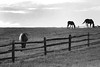
There was a 5 minute window period in an otherwise stormy day. It seemed fitting to take this picture. This was taken a couple of winters ago. I can't wait for winter to arrive - can you tell? :)
If you have a moment, please do yourself a favour and listen to this wonderful song sung here by two great artists - Katie Melua and the late Eva Cassidy. What a wonderful re-work. Somewhere over the rainbow
The Lighthouse
Second oldest working lighthouse in South Africa. Erected in 1848 and restored in 1988 to original plan. Built in Pharos style. Restaurant and Lighthouse museum.
History Overview
1840
It was decided in Cape Town to collect money in order to erect a lighthouse at the southernmost point of Africa. Donations from the public and the authorities were supplemented by contributions from Calcutta, Bombay, Madras, St Helena and London.
1847-8
Building operations started on 1 April 1847 and were completed in December 1848
1849
On 1 March the Lighthouse started functioning. Initially, oil derived from sheep's tail-fat was used for the lamp, which produced a stationary white light of approximately 4 500 candlepower.
1905
The tail-fat burner was replaced by an oil burner.
1914
A rotating optical system which radiated a white light of 470 000 candlepower every four seconds was put into use.
1936
An electric light generating 12 000 000 candlepower was installed.
1968
The lighthouse fell into disuse and was replaced by a warning light on an aluminium tower.
1973
The limestone building, which was modelled on the design of the Pharos of Alexandria, a lighthouse in Egypt and one of the seven wonders of the ancient World, was declared a national monument.
1983-8
The tower was restored to its original glory and permission was granted for it to be used as a museum under the authority of the board of Trustees of the bredasdorp Museum.
1988
Since 25 March 1988 the cape Agulhas Lighthouse has once again beamed its light over both oceans.
1994
On 28 January the Lighthouse Museum was officially opened.
Le phare de Goulphar ou Grand phare, est une tour de granit élevée en janvier 1836 sur les plans d'Augustin Fresnel. Il jouxte des bâtiments qui abritent les logements des gardiens, des chambres pour le personnel de passage et un local pour la station de contrôle du réseau Toran de Bretagne. Il s'élève à 52,25 mètres au dessus du sol et à 92 mètres au dessus du niveau de la mer. C'est l'un des phares les plus puissants de France. Sa portée lumineuse est de 26 milles (environ 48 kilomètres). Il offre un magnifique panorama sur Belle-Ile et le continent, du Croisic à Lorient.
The flagship Grand Goulphar or lighthouse, is a high granite tower in January 1836 in terms of Augustin Fresnel. It is adjacent buildings that house the housing guards, rooms for the staff of passage and a local station for the network control of Brittany Toran. It is 52.25 meters above the ground and 92 meters above sea level is one of the most powerful lighthouses in France. His luminous range is 26 miles (48 kilometers). It offers a magnificent panorama of Belle-Ile and the continent from the Croisic Lorient.
Construction on the Umpqua River Lighthouse began in 1890, after the original 1857 tower fell into the sea during a winter storm. This sentinel stands at the entrance of Winchester Bay and at the mouth of the Umpqua River. A sister to the Heceta Head Lighthouse, a few miles north, its signature flash casting its light some twenty miles out into the sea. Three years after construction began, the new lighthouse standing 165, above sea level was completed. On December 31, 1894, the First Order Fresnel lens manufactured by Barbier and Cie Paris was lit! In the 1960's, the light was automated. The chariot wheel that rotated the beacon became worn with age, prompting the United States Coast Guard to consider replacing the First Order Lens with a modern optic. People from the surrounding communities gathered thousands of signatures in protest. In 1985, the United States Coast Guard relented and the chariot wheels were rebuilt! In this, the 21st century, the First Order Fresnel Lens shines brightly. Lights up with 3 "AAA" batteries or your purchased 4.5v adapter, item# 13899.
Harbour Lights Collectible Replica in a Limited Edition of 1,200 pieces.
Le phare du Cap Alright, aussi appelé le phare de l'Échouerie, du nom d'une plage située tout près, a été construit en 1928. On le trouve dans le village de Havre-aux-Maisons aux Iles-de-la-Madeleine. Il est toujours actif.
Cap Alright Lighthouse. Established in 1928, this small light that we find in Havre-aux-Maisons village, is still active.
Nearest Town or City:
Havre-aux-Maisons Quebec Canada
Location:
Ile du Havre au Maison, Iles de la Madeleine (Magdalen Islands), Gulf of St. Lawrence.
Managing Organization:
Canadian Coast Guard
Tower Height:
27
Description Tower:
White, wooden square pyramidal tower with red trim.
Operational:
Yes
Date Established:
1928
Date Present Tower Built:
1928
Current Use:
Active aid to navigation.
Open To Public:
Grounds only.
Directions:
The lighthouse is at the southeastern point of the Ile du Havre aux Maisons, in the area known as Butte Ronde. From Highway 199 northbound take the Chemin de la Pointe Basse, then the Chemin des Echoueries; from Highway 1999 southbound, take the Chemin de la Dune du Sud, then the Chemin des Montants and the Chemin des Echoueries. If driving, the best way to reach the Magdalen Islands is by car ferry from Souris, Prince Edward Island. For details, see www.ilesdelamadeleine.com/ctma/madeleine_2.htm. Air Alliance (an Air Canada connector) offers air service from Montreal, Quebec City and other locations. (Thanks to Michel Forand.) Map It!
Characteristic Range:
Flashing white every 5 seconds, visible for 20 nautical miles.
Üsküdar ın sembolü haline gelen kule, M.Ö. 2475 yıllarına kadar uzanan tarihi bir geçmişe sahiptir. İlk olarak Yunanlılar döneminde bir mezara ev sahipliği yapan bu ada Bizans döneminde inşa edilen ek bina ile gümrük istasyonu olarak kullanılmıştır. Osmanlı döneminde ise gösteri platformundan, savunma kalesine, sürgün istasyonundan, karantina odasına kadar bir çok işlev yüklenmiştir. En uzun soluklu görevi ise geceleri gemilere göz kırpan feneriyle yol göstermesidir. Günümüzdeki kulenin taş hali Nevşehirli Damat İbrahim Paşa tarafından 1725 yılında yapıltırılmıştır. Kulenin adıyla alakalı bir çok rivayet vardır bunlardan en ünlüsü bizans imparatorlarından birinin suç işleyen kızını kuleye hapsettiği için buraya kız kulesi denmiş olmasıdır.
Light House aims to increase the enjoyment and understanding of technologically - based media, in particular film, video, photography and creative media and to emphasise their importance to the cultural, social and economic life of Wolverhampton, the West Midlands and further afield.
HISTORY
The formal opening of Light House took place on 16 March 1987 by the Mayor of Wolverhampton, Councillor Bishan Dass, although activities had already taken place since the August of 1986. Light House was housed in accommodation with the Central Art Gallery, there were only three members of staff and it was a joint project of the Council’s Leisure Services and Wolverhampton Polytechnic (now the University of Wolverhampton). The programme guide for that period included, amongst other activities, courses in video production, seasons of science fiction films, an exhibition India and Independence marking the 40th anniversary of India’s freedom from British rule and a conference about Black filmmaking.
Today Light House inhabits larger, partly-purpose-built accommodation, is an independent company and employs the equivalent of over 30 full time staff. There are still production courses, new exhibitions, films, educational activities, conferences and events. In addition, there are two major annual festivals and a myriad of activities that develop and support the growing creative industries in the City and region. The emphasis is still on giving opportunities for active involvement for everyone. Light House has held to its original mission, increasing the enjoyment and understanding of different media forms and using them for the benefit of the people of Wolverhampton and beyond. Along the way there has been support and encouragement from very many individuals and organisations. With their continued support, Light House will play an increasingly important part in the social, cultural and economic life of the City and the wider region into the future.
LIGHT HOUSE FUNDERS
A non-profit making organisation Light House is funded and supported by Wolverhampton City Council, Learning Skills Council, Arts Council West Midlands, UK Film Council, Screen West Midlands, Advantage West Midlands, Skillset and the University of Wolverhampton.
The formation takes its name from the former fourth[4] needle-shaped pillar called Lot's Wife that used to stand in its midst until it collapsed in a storm in 1764.[5][6][7] The remaining rocks are all short and squat and not at all needle-like, but the name has stuck.
The Needles were featured on the 2005 TV programme Seven Natural Wonders as one of the wonders of the South.
The Belle Tout lighthouse (also spelled Belle Toute lighthouse) is a decommissioned lighthouse and famous British landmark located at Beachy Head, East Sussex. It has been called "Britain's most famous inhabited lighthouse" because of its striking location and use in film and television.[1] In 1999, the Grade II listed building was famously moved in one piece to prevent it from succumbing to coastal erosion.
Beachy Head saw numerous shipwrecks in the 17th and early 18th centuries and a petition to erect a lighthouse started around 1691.[2] The calls were ignored for over 100 years until The Thames, an East Indiaman, crashed into the rocks of Beachy Head. The petition gained momentum with the support of a Captain of the Royal Navy and Trinity House, the official lighthouse authority, agreed to attend to the matter.[3] Having witnessed the incident himself, John 'Mad Jack' Fuller, MP for Sussex, used his influence and some of his personal wealth to fund the lighthouse construction.[4]
The first Belle Tout lighthouse was a temporary wooden structure that started service on 1 October1828. The construction of the permanent granite lighthouse began in 1829 and it became operational on 11 October1834. Its use of 30 oil lamps meant that the lighthouse would require 2 gallons of oil every hour.[3]
Circa 1691 petitions for a lighthouse were made due to the number of shipwrecks and sailors losing their lives at the hands of this dangerous stretch of coastline.
In 1828 as a continuing result of many shipwrecks, a wooden lighthouse was built on the top of the cliffs at Beachy Head. So successful was this that the decision was made to build a permanent lighthouse.
Belle Toute was built in 1832 and the location of the lighthouse was carefully planned so that the light was visible for 20 miles out to sea and that the light would be obscured by the edge of the cliff if sailors were too close to the shore.
Over the years erosion of the cliff reduced the effectiveness of the lighthouse and in 1902 Belle Toute was decommissioned when the new lighthouse built at the base of the cliffs came into service.
In 1903 it was sold by Trinity House and changed hands a number of times.
In 1923 it was bought by a surgeon, Sir James Purves-Stewart.
During the second world war with its owners being evacuated, Belle Toute was damaged due to shelling by Canadian Troops using it as target practice.
In 1948 Sir James offered the building to the council and eventually they took it over due to its historical significance.
In 1956 Belle Toute was leased out to Dr Edward Revill Cullinan who carried out works on the building and installed modern features such as septic tank, mains electricity and water.
In 1962 the lease was sold and changed hands a number of times.
In 1986 it was bought by the BBC who used it in the making of Fay Weldon’s “Life and Loves of a She-Devil”.
In 1996 it was bought by Mark and Louise Roberts to use as a family home.
In 1999, due to continuing erosion threatening the future of the building the lighthouse was moved 17 metres (56 feet) back from the edge of the cliff by the impressing engineering work of Abbey Pynford.
In 2007 the Roberts' have put Belle Toute up for sale with the guide price of £850,000.
In 2007 the Belle Toute Lighthouse Preservation Trust has been formed to raise enough money to purchase the lighthouse to open it to the public, provide bed and breakfast accommodation and maintain it for future generations of visitors to enjoy.
In April 2008 Belle Toute was purchased by the Belle Toute Lighthouse Company Limited with the intention of opening it to the public as a bed & breakfast and tourist centre.
In May 2008 the Belle Toute Lighthouse Preservation Trust wound-up although the Belle Toute Lighthouse Preservation Society has been formed to allow the previous members retain a watchful interest over this magnificent building. The website will be kept updated as an information resource.
*Please note: Previously we estimated the erosion based on .5m to 1m per year suggesting that the lighthouse would need to be moved in 17 to 34 years. This was based on our own calculations during 1890 and 1997, internet research and taking into account global warming. An erosion report that has come to our attention actually states that the erosion rate is more likely to be 0.03m to 0.27m per year depending on whether it is an 'active' or 'passive' recession period. We are working closely with Brighton University and hope to bring you some substantiated figures that suggest the erosion rate is .6m per year. This would suggest at a current distance of 18.2m that the lighthouse will need moving again in just under 30 years. More likely in around 24 years as it would be necessary to ensure access to the front of the tower by which time there should be 3.6m distance from the cliff edge.
It is important to recognise that averages are based on the middle value of a series of figures, although these figures are based on what has happened rather than what yet will happen. For example if within 100 years there was 50m of cliff that disappeared then the average is .5m per year, however, we know that falls can precede the average, i.e. that in 10 years there might be a cliff fall of just 1mm but in the next 10 years there might as much as 9m go, yet over the 20 year period the average might still only be .5m. Therefore it is very difficult to say when the next fall will be although it could be substantially larger than what is expected to be the average.
Gerard Donovan, who was born in Wexford and grew up in Galway, is a graduate of Johns Hopkins University. The author of two previous collections, Columbus Rides Again (Salmon, 1993) and Kings and Bicycles (Salmon, 1995), his poetry has appeared in journals on both sides of the Atlantic, including The Sewanee Review, New Statesman, Stand, and the Irish Times. After a career playing classical guitar in the eighties, he currently works as a professor in New York. In 1999 he completed the 140-mile Marathon des Sables in North Africa with his two brothers, later the subject of an award-winning documentary.
"Gerard Donovan is a man of two countries, teasing the beauty out of what lies in between. The LightHouse is easily his finest work so far, haunted, plaintive, hopeful and raucous. Like all good poems, they create a temporary silence around themselves, luring us in and stunning us. The LightHouse is a great collection." -- Colum McCann, Author of This Side of Brightness
"Donovan's poems are a joy to read. Their diversity defies categorization -- the poem glistens with detail." Irish Echo, New York
"Donovan is capable of taking an idea and unfolding it back to discover unexpected areas of meaning and suggestion." Poetry Ireland Review (from www.salmonpoetry.com)
Poems from The Lighthouse
The Body Lights
Not far from our window, the lighthouse dreams.
Its steel steps draft short breaths,
the granite flashes a heartbeat
under nightÕs vast sheet.
And now a breeze
parts the curtains into waves:
that glow again, like eyes opening.
When I dream, I too flicker between light and dark.
As you lie beside me, you see nothing of this.
You sleep like coastal distance,
another light in a long night,
your body spread from the pillow
like moon's reflection.
Your skin covers you like water.
You are as full of light
as your first breath.
Night turns restless on its side.
The first birds sing on whitening sea.
Starlings
In a boiling second
the starlings strip off trees
to a shrill scarf trailing in a gust,
curving, whipped, contorted,
crumpling to the roadside grass.
Today is colder, the wind north;
sparseness, contained a season, spills everywhere.
A few people walk the trails,
each breath marked, then released by air.
A child might see those birds as leaves
that scrape the sky with yellow veins.
I seem to lose that magic year by year.
I'm learning to open my hands; they fill
with what I let go. So I freed you too.
By the way, I forecast autumn by starlings:
it arrived today at two in the afternoon.
I had coffee and then came to the park
and it touched me on the shoulder ? just like that, I swear.
Zuhaf Gambotu
-
1896 yılında ‘Germania’ AG, Kiel firması tarafından tasarlanıp Osmanlı
Donanmasında göreve başladı. Ocak 1915 ayı itibariyle Çanakkale Boğazı
civarında k...
bugaboo
-
Definition: (noun) An imaginary monster used to frighten children.
Synonyms: bogeyman, booger, bugbear.
Usage: For me no terrors resided in the thought of bu...
-
The Snooze Tabs browser add-on is a key technology I use for category 2,
defending focus (and prioritizing) from my previous post (link in footer).I
noted ...
19.02.2026, 15:05.
-
Tütünçiftlik’te. Babaannesi var evde sadece. Mutfakta. Çocuk ise bahçede.
Taşların ötesindeki denize bakıyor. Taşların üzerindeki salyangozlara
bakıyor....
Çanakkale 4. Uluslararası Gastronomi Festivali
-
Ekibin değerli şeflerinden Damla Demirtaş ve Mücahit YeşilDün, Kolin
Otel'de düzenlenen ve bu yıl dördüncüsü gerçeken Gastrofest’teydik. Kentin
zengin mutf...
Zen and the art of household maintenance
-
The weekend arrives with a schedule of household tasks that never ceases.
There is laundry, and cleaning, and tidying, and the procuring of
groceries. D...
STC's 'Othello' on the Jersey Shore
-
Ben Turner (Iago) and Wendell Pierce (Othello) in Othello, Shakespeare
Theatre Company. Photo: Teresa Castracane In Simon Godwin's new production
of Othell...
Lettre au pilote du 31 mai 2003
-
Il y a exactement 23 ans, un jeune élève-pilote carrément stressé se
retrouvait tout seul en prononçant ces mots : "Fox Romeo Tango, je suis
prêt au roul...
Eski bir dostun ardından
-
Şeyh Abdul Celil -- Prof Steffen Stelzer1945 - 2026 Allah rahmet eylesin
English"Bir şeye yeteri kadar bakarsanız onda Allah'ı görürsünüz"
hakikaten b...
Romanika | Dijital E-kitap Okuma Platformu
-
İnsanlar belki de hiç olmadığı kadar okuyorlar. Sosyal medya okumalarını X,
hatta instagram içindeki okumaları yok sayamayız. Kimse çarşaf büyüklükte
gazet...
Unbreak my Heart PT.2 Sensual Song poem
-
Week-long trip ends early,
Quiet surprise enters the house to the sound of their love music spilling
down the hallway corridor from their bedroom,
Anticip...
-
Cu această postare s-ar putea să-mi dau reset la toată evoluția mea de
câțiva ani încoace, de când m-am hotărât să adopt niște principii noi și să
trăie...
DAT AI STUDIO
-
Yaratıcı dünyada teknolojik dönüşümler genellikle büyük gürültülerle gelir,
ancak asıl kalıcı olanlar her zaman sessizce yerleşen ve estetik algımızı
incel...
Maziden Gelen - 1
-
*Mayıs 2016*
*Yüreğin Kadar Kork Benden *
Aslında bir kuş gibi özgürdük, kanadımız incinmeden önce.
Sonra tutunmayı öğrettiler bize, dikili bir...
Sevgili Günlük
-
Her yılın başında günlük tutmaya başlarım ve öyle kararlıyımdır ki
neredeyse iki elim kanda olsa yazacağıma inanırım. Aradan on beş gün geçer,
bakarım k...
Thought - Reality
-
Words that spilled past open lips
Brought back memories of words said in the past
However, one should dwell on the true meaning of the words said on th...
50% Off Original Art Sale
-
Adding more lovely little things to my art shop. I'm extending my 50% off
everything sale to continue to raise funds for Sophie's urgent surgery and
treatm...
LinkedIn icin oneriler
-
Bir onceki yazimda, artik is dunyasindaki bir cok isleyisin LinkedIn
uzerinden yurutuldugunu ve onu dogru kullanmanin puf noktalarini ogrenme
gerekliligind...
Creating Engaging Blogs for Different Niches
-
How to Build a Blogging Background
A blog is a website where you can post text, photos, or videos. Some blogs
are primarily personal online diaries, while...
istanbul Mutlu Son Masaj Yapan Escort Gözde
-
istanbul mutlu son escort hizmeti sunan birçok eskort var, ancak Gözde’nin
müşterileri onun özel masaj hizmetini tercih ediyor. Gözde, müşterilerine
hem ...
Cuando había pasado el periodo del accidente
-
*Cuando había pasado el periodo del accidente*
me encontré con una sociedad distinta, una realidad distinta a como antes
la había sentido: la gente so...
Lendo e vendo notícias: ao correr da pena...
-
"Bento é um guarda-redes de futuro": E eu a pensar que o Bento foi um
grande guarda-redes do Benfica no passado!
"GYOKERES" : Não entendo esta obsessão d...
Apakah Anda Menyadari Semua Manfaatnya?
-
*Picosure Laser* - Apakah Anda Menyadari Semua Manfaatnya?
Jika Anda pernah mempertimbangkan perawatan estetika medis, Anda mungkin
pernah mendenga...
15+ Best Toy Storage For Living Room Gif
-
*15+ Best Toy Storage For Living Room Gif*. As you can see here, floating
shelves don't have to be boring. 6% coupon applied at checkout.
[image: Best W...
Day 8 - Partnership in Parenting
-
Day 8 of NaPodPoMo. We aren't talking a lot about the little one today. I
wanted to switch gears and talk about what it's like to move from just a
marriage...
The Yoshida Family Home, Mima-shi
-
Photo info:
Yoshida-ke Jutaku
Mima
Tokushima Prefecture
Photo date: October 2019
Photo location: Google Street View
*Click on photo for higher res...
Bit, Bit Android Update 32 64 To
-
with " shell folder extension) permits explorer thumbnails native 64-bit
and 32-bit variations for home windows 8x laptop, home windows 7, home
windows v...
Costura, minha menina
-
*Costura, minha menina*
” Avó, o que posso fazer quando estou desesperada?”
” Costura, minha menina. À mão, devagar. Aproveitando cada onda criada com...
Bulunduğu Yere Yakışmayan Heyecan
-
Bu maç, bu takımlar, bu lige hiç yakışmıyor...
Şimdiki adı Süper olan en üst ligin, Türkiye Profesyonel Futbol Lig'lerinin
kurulduğu günden bu yana genel ...
Anak Dengan Ibunya Yang Berjilbab
-
[image: Anak Dengan Ibunya Yang Berjilbab]
Nama gua Budiawan, umur gue sekarang 21 tahun, Gue ingin cerita tentang
pengalaman seks gue sewaktu kelas 2 sma,...
Ler para ser: uma questão de opção
-
Por: Rosa Amélia Silva
Ler é emprenhar-se de idéias, escrever é engendrá-las. Entre esses dois
atos, o segundo parece mais difícil. E acredito que não se...
Kasvetli Ev (Bleak House) – Charles Dickens
-
Bleak House - Charles Dickens*Kasvetli Ev* ilk bölümde Kasım ayı
Londra’sının koyu mu koyu, kapalı mı kapalı, çamurlu mu çamurlu, ama bir o
kadar da canlı...
10 Foods to Boost Male Health From WebMD
-
Men are different from women in all kinds of ways -- including their nutritional
needs. Just as women need particular nutrients during pregnancy or for
...
I Love My 4C Hair!!!
-
Hey blogger familayyyyy! See, told ya I would be back! Haha. Anyways, for
those that have been following me for years, you would have known that I
last l...
Ceramics, pottery and Mieli creatives
-
I went on a pottery course with Mieli Creatives together with my mother
some week ago and it was so inspiring, now I just can’t get clay out of my
mind. Ty...
Saxifragas
-
* Saxifragas especies y variedades *
El género Saxifraga comprende pequeñas plantas herbáceas vivaces de la
familia de las Saxifragaceae.
El grupo la...
CAM GİBİ DENİZZZZ - ÇEŞME SAHİLİ
-
Çeşme merkezde akşam eğlenceleri gece yarılarına kadar sürüyor. Marketler,
yiyecek alanları, gezinti yerleri ve eczaneler, geceyarısına kadar açık.
Sıcak...
El Vagabundo
-
*Paseas por el mundo vagando en tus sueños, **mientras estos vuelan,
sigues caminando sin rumbo.*
*El destino es un juego en el que tú y yo somos mera...
ITamaRU | Все об Италии для русских
-
Всем привет!
Я начинаю этот сезон с радостной новости - я наконец-то запустила проект,
который уже долгое время созревал в моей голове.
Я завела нов...
Fica a Dica...
-
“ Sexo é muito bom, mas estão enganados se acham que mulher vive
exclusivamente disso. Mulheres valorizam a cordialidade de um abraço, a
gentileza de u...
Summertime Vibes: Part 1
-
[image: photo Firebird.jpg]
{Firebird}
I've posted about the artist, Janet Hill, before but I don't think anyone
realizes how deep my love for her art tr...
tırnak işaretlerinin içindeki noktalamalar
-
Her ne kadar, aynı yazıyı kopyalayıp duran siteler silsilesine katılmak
istemesem de, önce tırnak işaretinin kullanımı için TDK'nın ne dediğine
bakalım:
B...
Arrabal y lo tercer espanhol
-
Fernando Arrabal tu eres
el tercer espanhol de mi coraźon:
Lorca, Pablito Picasso
y Fernando " Patafísico" Arrabal,
como un dia te he escrito en un poema...
farewell, maroc
-
My time in Morocco is coming to an end, and I'll be off to a new country
with a new job, and hopefully, a renewed sense of self. Though I grew to
love M...
Madeleines
-
Malzemeler 1/2 su bardağı un 1/4 su bardağı badem unu 1/2 tatlı kaşığı
kabartma tozu 2 adet yumurta – oda sıcaklığında 1/4 su bardağı şeker 1
limonun kabuğ...
Divine Feminine Expression of the Infinite 💫
-
Melanin Goddess
Power is in her stunning beauty, brown brawn body, nimble mind, deep joy,
and compassionate heart 💛... and more... in her connection to ...
TRAVEL DIARY > second day in Warsaw
-
Δεύτερη μέρα στη Βαρσοβία κι η μέρα ξεκινά με πλούσιο πρωινό στο ξενοδοχείο
μας Golden Tulip Warsaw Centre.
Ένα από τα μουσεία, που είχα στη λίστα μου ήταν...
Hayatım roman olsa
-
Blog sayfamın başlığında 'hayatım roman olsa yılın en sıkıcı kitapları olsa
1. olur' yazıyor.
Geçmişte yaşatmış olduğumuz -biz-ler çok enteresan.
Ne var ne yok?
-
*NOT: Bu yazıyı işyerindeyken, fırsat buldukça hazirladigim icin, gözümden
kacan hatalar olmuş olabilir. Daha kotusu, işyerinde Türkçe klavye
kullanamadig...
PLI Mulai Pasarkan Double Great Residence
-
PT Prioritas Land Indonesia (PLI) mulai melakukan pembangunan hunian
edukasi pertama di Serpong, Double Great Residence (dahulu K2 Park) pada
Desember ini...
Batam Segera Miliki Kampung Batik
-
[image: Batam Segera Miliki Kampung Batik]
Batam Segera Miliki Kampung Batik. Pariwisata di Kota Batam akan semakin
kaya. Tidak hanya menampilkan wisata be...
Lost Years
-
It is now 2018 and nearly November, the last time I wrote a blog post was
in October 2012 when I returned to South Africa from a short stay in the
UK...
Airport Download Kindle
-
This page contains about Airport six thousand ebooks from numerous authors.
The variety of these publications come in the following classes:
fictions/nov...
Download ebook Apache Mahout: Beyond MapReduce
-
Understand Apache Mahout: Beyond MapReduce Free Books On the net and
Download eBooks for free. Find 1000s of Apache Mahout: Beyond MapReduce
books to exa...
Yuk Lihat Ciri-Ciri Keloid Sejak Awal Kemunculannya
-
[image: Yuk Lihat Ciri-Ciri Keloid Sejak Awal Kemunculannya]
Yuk Lihat Ciri-Ciri Keloid Sejak Awal Kemunculannya. Keloid adalah jaringan
parut berlebih yan...
özgür aşk
-
Şimdi kasırga zamanıdır dedi kadın. Rüzgarın şiddeti öyle korkunç boyutlara
ulaşır ki, buraların yer çekimsiz bir uzay boşluğu olduğuna inanı...
How to prevent baby flat head
-
[image: How to prevent baby flat head]
Baby flat head is a syndrome common in babies between six weeks to four
months, although the problem is also spotted...
andante
-
sessizce ayağa kalkıyoruz. değerli eşyalarımızı toparlıyoruz. acil durum
eşyaları… anılar, Umay’ın Veda Busesi, Yaşamın ucuna yolculuk… fotoğraf
albümleri,...
8 yıl önce
Hello world!
-
Welcome to WordPress. This is your first post. Edit or delete it, then
start writing!
2017 Toys for Tots fundraiser Results
-
Here is the final Toys for Tots post for 2017!
This year was my biggest year yet for the fundraiser! We raised just over
$1,000 and got just over 200 toy...
Pimento "No Cheese" Dip
-
Every restaurant in Georgia had “Pimento Cheese Dip” on the menu. As a"No
Dairy Queen" I was curious. Here’s the Vegan version I came up with after
looking...
Sayıklamalar ...
-
kısık sesli cümleler kurma bana... bağır... bir kez olsun durdur... susma
konuş bir kez olsun doğrusunu anlat hep gitmek ve kalmak arasında gidip
gelme bir...
-
I was contacted via Witch's Voice from a local radio station in Havre de
Grace with an invite to appear on the morning show on Tuesday Halloween
morning. ...
7 Tips Untuk Memilih Minuman Mineral Kemasan
-
Tak dapat dipungkiri bahwa air kemasan menjadi kebutuhan setiap orang dalam
aktivitas sehari-hari. Namun, akhir-akhir ini air minum dalam kemasan telah
men...
Feliz dia dos Pais meu Pai
-
Pai, se um dia eu tivesse que escolher um herói, um rei, um anjo, um
protetor, com certeza seria você. Você foi o melhor advogado, o melhor
amigo, o m...
SIKAYET I
-
şikayet etmeye geldim, gidicem
birincisi, su yorumlarinda masaALLAH, masALLAH yazanlardan nefret ediyorum
neden bu abartma istegi
neden bu vicik vicik abart...
Je vais tâcher d'écrire une fois par semaine
-
j'ai commencé un blog nouveau, PathwaysExperience.blogspot.com et depuis
trois semaines j'écris jour à jour: quelle joie!
je me suis rappelée combien c'éta...
Vintage Postcard Project
-
1. What is your favorite image and what does it represent?
- My favorite image is the first image beach I think it is a very positive
and spirited rep...
SIN LLANTOS NI RISAS
-
Tiempo hubo de penumbras
de marchitos caminos desolados
y llantos, y risas solo eran ceniza...
sin embargo en la magia del aire
y sus hilo...
Cosmic Vertigo
-
I'm pleased to announce the LAUNCH of my new space podcast, Cosmic Vertigo,
made with co-host Alan Duffy and our amazing producer Joel Werner.
"Do you e...
Verdemais... de Rui Machado
-
a exposição que convida a ver demais!
Logo no início deste ano de 2017, meu querido amigo Rui Machado volta com
sua temática amazônica e nos presenteia no...
Se se bir ki bir ki deneme
-
Sevgili Lalenin bahçesinin bloğuna yazılan yorumlarda bloguna giremeyen
arkadaşlarımız var. Ben de bi denedim. Hı hı tamam. Girebildim. Ok. Bye bye
😁 belk...
-
http://arsiv.sabah.com.tr/2001/02/19/y03.html
Bestesi bilinmeyen garip şarkılar
Toulouse Lautrec soylu ve zengin bir ailenin çocuğuydu.
Küçük yaşta attan d...
Kampanya / Kaşıkara ilköğretim okulu için destek
-
Merhabalar,
Aşagıdaki çağrıya destek olabilirseniz cok sevinirim.
"Blogların eski işlevini yitirdiği bir dönemdeyiz. Her şey bir kaç cümlelik
kısa mesaj v...
Working Title
-
Photo Credit M Sarki
It is disconcerting to me when at times a stranger stops dead in its tracks
in order to converse with me, or at time...
Automatic Gate Repair Beverly Crest
-
Automatic Gates El Segundo
Automatic Gate Repair Beverly Crest. Garage Door in Glassell Park, CA.
Garage Door Repair Canoga Park, CA. Automatic Gates South ...
Partner Bisnis Masalah - Sebuah Pendek Kuis
-
Solo lain, klien sering berarti adalah membawa nama baik dan reputasi
dengan mereka. Banyak orang yang tertarik untuk memulai sebuah rumah Anda
berbeda pe...
-
8 years.
The last 8 years of my life have been a blur of happiness, sadness, anger,
deceit, elation, changes, resentment, love, shame, tears, joy, and pass...
Mom Not Taking Care of Herself
-
As a mom I don't pay enough attention to my own health. It was brought to
my attention by my doctor that in 10 years I've seen a primary care doctor
only ...
Sunum: Orta Doğu ve Afrika'da Dijital Fırsatlar
-
Bu sunum 30 Mayıs 2012 tarihinde İstanbul'da Webrazzi etkinliğinde Mehmet
Nuri Çankaya tarafından gerçekleştirilmiştir.
Sunumun Video Kaydınız izlemek içi...
Why hello 2016
-
Hello hello!
It's great to be here! I've been the length of the country [almost
literally] already this year. From shoots in Cornwall to Banff Scotland,
w...
How To Play Roulette
-
Even for those who have yet to step into a single casino, roulette has to
be one of the most (if not the most) iconic games often featured in your
standard...
Im back
-
It's been 5 years since I last posted on here. A lot has happened since
then, its been quite a journey to say the least… Maybe I will share as I go
along.
...
Os Meus Preferidos ao Oscar 2016
-
* A cerimonia do Oscar 2016 acontecera no dia 28 de fevereiro e sera
transmitida pelo canal de TV a cabo TNT .*
*Depois de ter assistido filmes indic...
Carnaval
-
Nenhum espírito equilibrado em face do bom senso, que deve presidir a
existência das criaturas, pode fazer a apologia da loucura generalizada que
adormece...
Let it go, let it gooo...!
-
Ugh, I bloody HATE that song.
It's the overcommercialised, sacharrine fueled kind of crap that really
gets my goat. The only current song that comes aywher...
Pride and Prejudice and Zombies (2016)
-
Release Pride and Prejudice and Zombies in HD QualityNow you can enjoy
Pride and Prejudice and Zombies in best quality with duration 105 Min and
has been ...
Bi arkadaşa bakıp çıkıyorum
-
Uzun zaman ara verince nasıl başlanır bilirsin "bloguma uzun zamandır
yazmıyordum bir uğrayayım dedim, özlemişim..." falan filan. İşin açığı
ÖZ...
Kinky Snowman
-
All bakning behöver ju inte vara just för ätande stunder. Man kan ju även
pyssla å knåpa med en deg, om man anser att bröd inte é nyttigt. Jag älskar
a...
Resep Cheese Cake Yang Lembut Nikmat Serta Simpel
-
Untuk kamu yang sukai camilan pas sekali cheese cake tersebut juga sebagai
camilan kamu dengan rasa yang paling nikmat serta ciri khas untuk cakenya.
Yang ...
The Boat Builder (2015)
-
Watch Full The Boat Builder in HD FormatNow you can enjoy The Boat Builder
in high quality with duration 88 Min and was released on 2015-11-06 with
MPAA r...
Southpaw (2015) Download Full
-
I recommend this movie to everyone out there want to see an epic action
movie that delivers to every sense of the word and I'm not WHO Easily could
be co...
2016 Calendars
-
My desk calendars are back!
I've created six 2016 calendars for my Elle Moss, birdandbloke and
alicebgardens shops on Etsy. They are loose desk calendars ...
Survivor (2015)
-
Full Length of Survivor in Best Video FormatNow you can download full
Survivor in best quality with duration 96 Min and was released on
2015-05-29 and MPA...
All About E (2015)
-
Free All About E in Best LookNow you can watch full All About E in HD
quality with duration 120 Min and was published in 2015-02-21 and MPAA
rating is 0.
...
Key House Mirror (2015)
-
Full Length of Key House Mirror in Best LookNow you can watch full Key
House Mirror in HD format with duration 91 Min and was published in
2015-11-12 with...
This Isn't Funny ()
-
Watch Full This Isn't Funny in Best QualityNow you can watch full This
Isn't Funny in best quality with duration 86 Min and has been aired on and
MPAA rat...
Dünyanın en şansız şanslı adamı
-
Hırvat, Frano Selak, 81 yaşında emekli müzik öğretmeni. Onu özel yapan ne
yaşı, ne mesleği ne de ülkesi. Frano'yu özel yapan şey, *Ölümsüz* filminde
seyr...
Checking In
-
Hello! Is anyone still out there?!
I can't believe I haven't blogged in YEARS! Wow! So much has changed over
the years but I love looking back at this blog...
Living Room Design Ideas, Pictures, Remodel & Decor
-
The parlor may be more formal than the family room, yet that doesn't mean
it needs to feel cool and character free. It is the "living room", taking
all thi...
13 || My Fitness Journey To a Marathon
-
Fitness isn't always easy but it can be fun at times. How many times have
we diet and exercise plans meanwhile the only running we accomplished was
to th...
Liver Cleanse Supplements for Removing Impurities
-
There is no denying the way that it is truly impractical throughout today's
occupied individuals to utilize herbs as liver detox specialists. This is
on ac...
Never Let Me Go (2010) Volledige
-
Watch Movie Never Let Me Go Full Movie HD. Download Never Let Me Go Movie
Streaming with duration 104 Min and broadcast on 2010-09-15 with MPAA
rating is ...
DİKKAT, SAĞLIĞA YARARLIDIR!
-
Çiğ beslenmeciler arasına katılalı beri rengarenk salatalar yapıyorum. Siz
bilmiyorsunuz tabii, buraya yazmadım ki hiç birini. Olabildiğince çiğ
olarak tük...
Mulberry Roxette
-
Voici les photos que j’ai faites le mois dernier à l’occasion de la sortie
de la collection Roxette de Mulberry. Apres la visite de leur nouvelle
boutiqu...
souvenirs
-
By By From Lombok Many people want to go to Lombok in West Nusa Tenggara
Province. Region which is famous for Senggigi Beach, Kuta Lombok's Sasak
and Weavi...
Bitenler...
-
*Nuxe Huile Prodigieuse Multi Purpose Dry Oil :* Aranızda Nuxe ürünlerini
sevmeyen var mı? Sizi bilmem ama ben bayılıyorum, bu yağı saçlarım için
kullandı...
Be More Than Just A Pretty Face
-
Dear Models, Actors, Hosts, Comedians, and Newbies:
...in other words, please do not depend solely on your looks when it comes
to trying to book gigs.
...
Dawn of the Dead (2004)
-
Download Dawn of the Dead in Top-Video-FormatJetzt können Sie download Dawn
of the Dead in Bester Blick mit der Dauer 109 Min und erschienen in
2004-03-10...
Still Here
-
I used to post a lot. Life got in the way. When I started my blogs I was a
stay at home mom. I began fighting cancer. This blog was my place to not
talk ...
I Want...
-
“I want to be the first thing you touch in the morning and the last thing
you taste at night.” ~ Sadie Andria Zabala
Credit to Sex4theSoul
The Anticipatio...
Golden Slumbers Beatles Album
-
Many wished that a wall was being formed between him and his younger
brother Lakshmana is said to have Beatlemania, which hit the golden
slumbers beatles...
Dmz Tour Seoul
-
Until the Japanese General Government Building was contructed in front of
Heungnyemun Gate. The guardsmen perform several ceremonies including the
dmz to...
Dancing With Wolves Costner
-
For anyone involved in the dancing with wolves costner of the dancing with
wolves costner will think you're a beginner once. You will find that some
of w...
Gerçeğin Elli Tonu
-
Yeni kitap falan derken ‘Grinin Elli Tonu’ ile ilgili yazmaya biraz geç
kaldım. Grey’in Mehmet Aslan’a olan benzerliği, Anna’nın sarı baldır
tüylerinin gö...
Viy (2014)
-
Best Viy in Best Video FormatNow you can see Viy in high quality with
duration 130 Min and has been launched in 2014-01-30 and MPAA rating is 11.
- *Or...
Bir Öykümüz Var: Oniva
-
Bugün sizlere Oniva’dan bahsedeceğim. Evet bir öyküleri var onların ve hep
birlikte yarattıkları bu öyküyü, yani Oniva’ya göz atacağız. Amacımız ne
mi? D...
-
uyuyan kişi, saatlerin akışından, yılların ve dünyaların sıralanmasından
oluşan bir halkayla çevrelenmiştir. uyanırken içgüdüsel olarak bunlara
başvurup ye...
Sei quem tu és.
-
imagem: google
*Passado Cabrão*, enquanto lambe os lábios e afia os dentes, olhando
gulosamente - Olá! Lembras-te de mim?!, pergunta ele em voz suave...
De volta à insónia
-
aceito a inutilidade que carrego nas mãos,
os quartos são sempre iguais,
o eco das paredes
permanecem terrivelmente sós,
tão sós como as folhas que se mu...
-
Hello!
I know it's been f-o-r-e-v-e-r since I posted, but I am stating my New
Year's resolution now that I will begin posting regularly again on this
blog...
Mozzik ft.Enca - Edhe Njo
-
[for higher quality change the resolution of the video to 480p or higher
when available!]
Music Video 2014
Artists: Mozzik, Enca Haxhia
Title: "Edhe njo"
...
-
Hello, Blog
It's been a while.
Fuck it. I hate everyone and my haters are right and I'm a big ball of
failure and all I want to do is sleep.
Fuck you.
November 18, 2014 My Blog will Be Renewed!
-
Thank you to my readers for all the comments and emails wanting me to keep
my blog going. first my blog was reported as porn (not!) and then the past
two ...
As duas vidas do Souza
-
Souza tirava o vestido de Luzineide, quando ela parou e empurrou o amante :
- Me responde agora : ou ela ou eu ?
- Não entendi. Ela quem ?
Luzineide colocou...
داستانهای من
-
"زن با پای خودش نیامده بود، کسی گذاشته بودش پشت در ورودی و رفته بود. چند
وقت میشد بچه توی شکمش مرده بود؛ جای کبودی روی پهلوها و خونمردگی زیر شکم.
راهرو را...
Emeral Isle Redux
-
*"A Few More From My Recent Trip to Ireland...*
------------------------------
* ------------------------------ ------------------------------
-----...
February?
-
I didn't realise I hadn't checked in for so long. I was always told that as
I got older the days would go quicker and despite my best efforts in not
trying...
Tus ojos - Octavio Paz
-
Imagem: Claude Monet
Tus ojos son la patria del relámpago y de la lágrima,
silencio que habla,
tempestades sin viento, mar sin olas,
pájaros presos, d...
Am I Dreamin'?
-
The life that I have so carelessly, yet carefully built is about to be
revamped. Reconstructed. I'm feelin'....REVITALIZED. RECHARGED.RENEWED.
Never th...
Let it Go, Let it Go...
-
I am so close to making this blog into a sisters empowering sisters type
joint. I am fed up with hearing stories of women selling themselves short
and sett...
Sem definição - Fernanda Mello
-
Não sou boa com números. Com frases-feitas. E com morais de história.
Gosto do que me tira o fôlego. Venero o improvável.
Almejo o quase impossível. Meu...
Beater drawing of Mr. Wonderful
-
After a long time without doing a giveaway at tip and heel, not only today
I bring you a draw but that also is a tremendous draw!... Beater because
Mr. Won...
Happy New Year!
-
It's a brand new year and i'm going with it. I will no longer be waiting
for change. I've decided to start Reconstructing Wonderland. Join me!
Etsy Love: Winter Knits
-
Keep cozy this winter with some handmade knits from some of my favorite
Etsy shops.
A Girl Named Leney
Love and Knit
Royal Windsor Knits
The Prairi...
Informasi seputar tips kesehatan
-
*Tips Kesehatan* - Kesehatan merupakan kebutuhan yang sangat pening bagi
setiap orang. Kesehatan adalah sebuah nikmat yang harus disyukuri.
Kesehatan adala...
sophia.
-
pikaptan müzik dinlemek çok farklı derlerdi anlam veremezdim. sonra
bodrum'da bir temmuz günü minik bir odada pikaptan "son arzum" dinledim.
kapaktaki deh...
Eda
-
5 aylık Eda 5 aylık olacak bu haftasonu. 5 aydır 7 gün 24 saat beraberiz.
İlk günlerinde telefondaki bir uygulama
ile her gün fotografını çekip o gün yapt...
New Travel Site is Up!
-
Hey folks! The new travel website that combines all my other adventures is
finally up. Click here to be redirected to SwimmingCow.com where you'll
find ph...
doce novembro
-
-
*Todas as fotos deste site estão protegidas pela LEI DO DIREITO AUTORAL, Nº
9.610, DE 19 DE FEVEREIRO DE 1998. Proibindo sua reprodução ou divulgação
...
Doxa
-
Hello everyone!
I recently got involved with an art and culture group called Doxa. It's a
place for women to share and collaborate their creations in a fri...
Foto Maharani Suciyono Cewek Yang Di Tangkap KPK
-
Maharani Suciyono ditangkap ketika sedang berdua dengan Ahmad Fathanah,
penerima suap PT Indoguna Utama, di Hotel Le Meridien. Belum diketahui
secara pasti...
Four Years Later - Reflection and Resolution
-
Some of my recent favorites-click to enlarge
For the one or two people who actually still read my little blog that
started as an outlet for me to expre...
Juliette Lewis
-
21 Haziran 1973, Los Angeles, Kaliforniya doğumlu Juliette Lewis, aktör
olan babası Geoffrey Lewis ve grafik tasarımcı annesi Glenis Duggan Batley
(boşan...
Baked Cheese Dip with Tomato and Basil
-
I'm excited about this years Superbowl, yes, me, excited lol. And of course
it has nothing to do with football but more so for the sole fact that
Beyonce...
Joint programs and international partnerships
-
Some of its academic programs are offered as joint degrees or in
partnership with foreign universities: Its Master of Science in Information
Technology is ...
Egy swinger nőci naplója
-
Érdekes blog: szexuális tapasztalatok első kézből egy nő szemszögéből.
Tanulságos lehet nekünk férfiaknak. Érdemes olvasgatni. Tanulhatunk belőle
ezt-azt ...
Atılmış cümleler atölyesi
-
Atılmış cümleler ataölyesinde gepetto rolüne bürünmek ne komik. Cansız bir
dünyaya can getirmek! Neresinden bakarsak bakalım elle tutulur bir yanı
yok. G...
payîz
-
*5 eylül*
akıntıya karşı yüzmek, bin cephede on bin savaş. yorucu evet.
6 eylül
montreal film festivali'nde büyük ödül, türkiye'de minimum seyirci.
uzak...
Health and Wealth
-
My mom has always tried to drop a wealth of information on me regarding my
health and taking care of my body. Being the "rebellious" teenager/ young
adult ...
-
Não sei o que estou a sentir , não sei o que estou a pensar , sinto-me
sozinha e completamente perdida tu eras o meu mapa , o meu mundo onde eu
sabia todos...
Mais de 3 meses depois
-
Voltamos a escrever qualquer coisinha por aqui! A minha ausência deveu-se
primeiro a problemas técnicos (pc estragado, pc novo) e depois a falta de
temp...
Aydınlık Gece
-
Yazın gecesinde, günün ışığından koruyan örtü serildiğinde üzerimize, serin
bir ürperti duyuyoruz ve mırıldanıyor ağustos böcekleri. Ateş böceklerinin
raks...
This blog has moved!
-
Hello!
Well, it's the end of an era for me as I say a fond farewell to blogspot.
It's been a wonderfully exciting few years and blogspot has been
marvel...
World Pinhole Photography Day 2012
-
*St Peter's Church - WPD 2012*
Now, when I tell you that World Pinhole Photography Day (WPPD) 2012 was
over a month ago, you'd be forgiven for thinking tha...
Preserving the future
-
Turkey is the youngest country in Europe. The average age of its population
is below 30.
It is also the most ancient. An invaluable cultural heritage is...
Favorite Childhood Poetry 4
-
Although I thought that I had completed my three-part series on my
childhood favorites, today as I was surfing I discovered this beautiful
artwork by Sc...
blown.
-
I just had the most ridiculous conversations of my life. On some I wish I
had a pistol right about now type of conversation.
Remember I told yall about my ...
Right...or Right Now?
-
This is a phrase or reference that we have all heard before…*Mr. Right* or *Mr.
Right Now*. There are books, t-shirts, Oprah’s talked about it…my thoughts ...
Au soleil
-
Tous les après-midi au parc avec ma belle...Lui faire découvrir les arbres,
le ciel bleu, les feuilles, les oiseaux... Une semaine merveilleuse...
The Plight of A Janet Stan
-
Yes, it’s been quite some time since the last post. I’ve been very busy
with school, working aisle 5 at Wal-Mart to try to #GetOnIt and still
#CantAffordIt...
222012
-
reaching for insight
grasping thin air
let down again
once-something-next-to-decent
lost it somewhere in-between
shared secrets
and sideways glances
losing...
Hands in the Earth, hands held together
-
Its been a year since my church proposed developing a community garden.
There were a lot of set backs, mostly financial. Just leveling the ground,
removin...
Changes
-
Hi Everyone -
There have been a lot of changes going on over here in Oasis-land over the
last little while and sadly the time has come that, for personal ...
SuperPAC or SuperCRAP
-
In 2010 we experienced the United States Supreme court ruling in
Citizens United vs FEC (Federal Election Commission.) The decision by the
U.S. Supreme ...
Leaving New York!
-
My official going away party is scheduled for Saturday, January 14th in
Brooklyn. I will be subletting out my place in NYC for the next seven
months and w...
Resolved
-
Here's the New Year's Resolution I can admit to no-one in my real life, but
it's the only one I care enough to make:
*I resolve to win my freedom this...
Son Mektup
-
(Yaklaşık 1 sene önceydi.. Ve son mektubumdu.. Tesadüfen gördüm dün gece ve
1 senede ne kadar değiştiğimi farkettim.. Sonra aslında ne kadar gereksiz
bir...
Tughra: The Sultan's Seal
-
[image: Tuğra: Seal of Sultans]
A tughra is a calligraphic seal or signature of an Ottoman sultan that was
affixed to all official documents and correspond...
Photon diffraction in autumn forest
-
Photon diffraction is a situation where photons travel through a material
without being absorbed, but rather undergoing repeated scattering events
which ...
Pas simple... Pas simple...
-
...de vivre à deux.
Sommes-nous fait pour vivre à deux ? Je ne suis pas le premier à poser
cette question mais je n'ai pas, pour autant, la réponse.
Quant à...
-cricket-'s photostream
-
[image: threeonahill][image: 13 more days...][image: Outside my window][image:
Very late][image: Very very late][image: Snowy rider]
[image: Long commute ho...
Today's message brought to you by the Holy Spirit
-
So the first couple of weeks of semester II have been stressful. That's an
understatement. I don't have time for anything and I have to admit *for the
firs...
-
"A vida é o filme que você vê através dos seus próprios olhos. Faz pouca
diferença o que está acontecendo. É como você percebe que conta."
(Denis Waitley)
SU gibi
-
Dostlar ırmak gibidir Kiminin suyu az, kiminin çok
Kiminde elleriniz ıslanır yalnızca
Kiminde ruhunuz yıkanırboydan boya
İnsanlar vardır; üstü nilüferlerl...
Olá e adeus
-
Olá amigas blogueiras e seguidoras este blog tal como é já não faz sentido
para mim por isso criei um novo que continuara a ter boas receitas mas com
uma a...
teruntuk kamu yang disana.
-
ternyata tidak segampang membalik telapak tangan untuk bisa melupakanmu.
jelas2 ada yang lebih baik berada di hadapanku, tapi entah kenapa beberapa
kali kud...
So, I suck
-
At blogging. Sorry guys. I dropped the ball.
But my summer in France has been absolutely wonderful - although extremely
full and busy. Which was definitel...
She's Thinking...
-
*If you are not getting as much from life as you want to, then examine the
state of your enthusiasm. *
*-Norman Vincent Peale-*
The above is today's quote...
It's Been A Looooonnnng Time
-
I've been super busy because my dreams are coming true! She's Got You Stoned
is up and running. I started the online business a little over a month ago
and...
hiiii
-
thanks to melanie denise, i just realized that i havent blogged in a
year!!!! long story short, i'm RECOVERED, and i've never been so happy in
my life!!! i...
The Sartorial-twist
-
It's summer, so I have plenty of time in my hands and not enough energy to
actually do something even mildly productive. In fact, I've spent a
probably u...
El Yapımı Broş
-
Bu el yapımı takıları çok beğendim.En çok da renkli bukalemunu.Broş olarak
kullanılabilir.Şirin gözüküyorlar.
İlgili link burada.
Yaplan 2 yoruma burada...
Libya’daki Anılarım
-
Tunus’ta başlayan isyanlar Mısır’a sıçradı ve domino etkisiyle Libya’ya
ulaştı. Ortadoğu da yaşanan bu karışıklıklar esnasında bir çok insan öldü.
Böylec...
24 saat Assos...
-
Haftasonu Assos'a gittik, iki gün içinde olsa bulunduğun şehirden uzaklaşma
çok iyi geliyor insana...Pazartesi sabah ofise gelip bilgisayarımı
açtığımda...
24.05.2011
-
I haven't felt this alone in a long time. Even when I'm talking to people,
it feels like they would rather be doing something else, or are doing
something ...
L'armée furieuse de Fred Vargas
-
*Avec Vargas il faut abandonner notre esprit rationnel pour se laisser
guider dans son monde décalé à la limite souvent du loufoque mais
finalement ...
This Is Just To Say..
-
Well...I have definitively NOT eaten the peaches which you were saving in
the ice box. Because I can't eat anything. Because the hideous taste in my
mouth ...
Stranded
-
I can’t bring myself to delete your number.
But I can’t bring myself to dial it.
In even greater distance and silence, I want you closer than before.
I trav...
İnternet Sansürü ve Toplum Baskısı #22Agustos
-
Yeni İnternet sansür yasa taslağına göre internet servis sağlayıcılar,
farklı erişim yetkilerine sahip dört kullanıcı profiline göre hizmet
sunmakla yüküml...
You Should Remember
-
I go ghost sometimes.
Sorry? I am. But don't I make it worth your while?
Yes! And if I don't, don't correct me!
I need my ego these days.
Here's a 10-1....
The Greatest Book Never Read
-
Surely it would be great folly,
not to read the greatest book ever written.
And yet, here we are.
A book, perfectly preserved in mint condition
never once ...
Aforismos libidinosos
-
El tiempo se altera, cuando tu existencia absurda se enciende, gracias al
éxtasis intenso que te disuelve y te hace renacer.
La sangre fluirá con mayor ve...
LOVE (140 characters or less)
-
I have a new rule: If you're tweet/topic is over 4 tweets long- go blog
about it. It's no longer a "twittle tweet." It's something worth blogging
about. We...
-
"siz bu adamlara, sizi sıkıldığınız hayatınızdan çekip çıkarsın diye mi
aşık oluyorsunuz yoksa sıkıldığınız kendinizden kurtarsın diye mi?"bir iki
gün önce...
Natural Sunshine has moved!!
-
Hi everyone! *waves feverishly*
I have the most exciting news!!! My little sanctuary here is moving over
to WordPress!!! So please follow me over! I ha...
Heart and Soul
-
We are currently studying cardiovascular physiology in school, and my
professor told an interesting story about compliance of blood vessels in
relation to ...
One of my wonderings.
-
What do people with extreme mohawks do when they go to bed? Do they wash it
out so it is flexible and then put it in a few pony tails? Do you think
they sl...
Aldatma ve Argonot Erkekler
-
Artık iyice kabullenmeye başladım.. Daha önce de bilidiğim ve savunduğum
bir durum olmasına rağmen, insanların zaman içinde farklı düşünceler ve
kültürler...
Happy New 2011
-
Wishing everyone a peaceful and productive year ahead.
Speaking of productive times, I am writing. Actually writing. This is
thanks to many writing websit...
That's Right, We're Hiring!
-
This year Aspiring Couture is starting off right with plans, goals, and
everything else needed to make the year an incredible one! In order to
facilitate e...
müsait bir yerde binecek var.
-
valla ben de Pearl Jam "Black" i yazmış olmayı isterdim, ama öyle bir
şansım yok....
yani demek istiyorum ki, burda yazanları "çalan" arkadaş; ne var ne yok...
What's New?
-
*Just what is going on here?*
You may have noticed some changes and activity going on with my work on the
blogging and writing scene. Well... I have been ...
signs
-
I am happily pet-free at this time, and with the crushing loss of two
family dogs over the summer I plan to stay that way for a while.
We live in an apart...
EVERYTHING MUST GO @ CALUMET LIVERPOOL
-
With only 4 weeks remaining there are further reductions at Calumet
Liverpool.ALL STOCK MUST GOVisit our Liverpool Showroom and make us an
offer!HUGE SAVIN...
Canım.
-
nabersin. Herhalde buralara gelip bana karşı taciz planları yapmayalı çok
oldu. Bak senin için blogu yine ve yeniden açtım. Ahah. Evet, iflah olmaz
bir ç...
Hello
-
After a long absence - HI to one and all. Yes I am alive and as
usual...stressed. The show is over, I've slowly recuperated my energy -
wonderful warm weat...
-
Throw Your Diamonds in the Air.Furrowed brow: check. Angry demeanor: check.
Anxiety due to over thinking a life decision I can't figure out the right
answe...
Etsy Feature - Blue Marbles
-
*Crystal:* Shameless...I know....but I had to take the opportunity to
promote my own Etsy shop on here since I've finally got it up and
running....I have m...
Shouldn't paydays be great?
-
So again, paid and then broke for two weeks! I am counting down the months
until I am not living paycheck to paycheck. The creepy haunted past of late
noti...
Last Night's Party
-
My proud Virgo friend's birthday finally came around and I was excited to
help her celebrate.. First we did karaoke at Katra lounge; followed hookah
at Fal...
Moved!!!
-
This blog has moved!
Please check my profile or email me (notesfromthetoothfairy@gmail.com) for
the new link!
If you want to, follow me there again!
sorry...
Song of the day
-
::ahem:: Jeez it's been a long time, I know I have abandoned the blog for
quite sometime. I apologize! Dont know what made me log on, but I do know
that I ...
things that shouldn't be said out loud.
-
Everyone tells me I look like my dad. My birth mothers second daughter
looks just like her. They have the same nose, the same mouth, the same
eyes, and the...
Blog Dergisi Eylül Sayısı #Sayı: 13
-
Ağustos ayında 1. yılını kutlayan Blog Dergisi yeni yaşında yeni sayıları
ile karşımızda... Bildiğiniz gibi tüm ekip gönüllü olarak bu çalışmada yer
alıyor...
-
Yankel Dickerman asistio al curso teórico practico sobre el arte del
performance y el uso del cuerpo como material de trabajo en el Museo
Bolivariano de Ar...
Mr Sex: World Cup Willy
-
So, the World Cup's on, and the northern half of Todger Talk is dead, dead, *dead
*excited about it. And also painfully aware that he hasn't tossed up a blo...
Miranda Kerr - "school girls" modeling
-
[image: Miranda Kerr]
The new publicity photo shoot of Miranda Kerr, some are quite challenging
and strange.
Miranda Kerr' s sexy school girl modeling appea...
window nude
-
window nude
Originally uploaded by blueriverdream
testing some things with how the interwebz are connected. Trying to change
my paradigm. Some naked and a ...
my new blog
-
with lots of encouragement from friends & strangers alike, i created a new
blog where i customize drink recipes according to ppl's favourite spirits.
i can...
THE 10 THINGS in LIFE YOU CONTROL
-
*Contributed By - Kunal Mittal*
There are just a few aspects of life that we can truly control, and it’s
useful to know just what those areas are. If you ...
This blog has moved
-
This blog is now located at http://turkce.turkishcookbook.com/. You will be
automatically redirected in 30 seconds, or you may click here. For feed
subscri...
Yeşil Eldivenli Adam
-
Borges Yusufeli’nde yaşasaydı ya da Bukowski; eminim kapak atacakları
mekanların başında Ahor gelirdi. İçkisiz fakat fazlasıyla bohem bu kahvede
diledikle...
Stone Temple Pilots Unplugged
-
Lejano queda ya aquel día de 1981 dónde se emitió el famoso Video Killed de
Radio Star, gran comienzo de una cadena novedosa, que emitía música las 24
hor...
Minnesota Winter Scenes
-
Winters in Minnesota can be very dramatic at times and very beautiful. I
have learned to tolerate the harsh winter days by going outdoors with my
camer...
I'm moving!
-
*I don't have many blog readers here (that I know of--some of you may be
stealthily stalking me lol) & in order to make good with a new years
resolution I...
Oh.....Life
-
Life is what you make it. I'm trying to make the best of mine but something
always seems to get in the way. No complaints. I'm just moving along and
tryin...
Michael Jackson Medley
-
This guy is crazy! At first, I didn't think this was that good... but
listen all the way to the end. If he made this whole video and wrote the
medley himse...
Dream Weaver.
-
This is one of my latest digital art works using Corel Painter X.
Titled "Dream Weaver"
Dreams, Intuition, Hopes & all things we yearn are given to us th...
PROVIDENCIAS DE MIS ENCUENTROS...
-
En transición constante surge y mana el tiempo de la nada, en sucesivos
encuentros con el momento que plasma de sentidos consecuentes los
presentes, que se...
-
I'm hanging up this blog, to start the new year off. Posting here without
Traci would be like flying in a circle, and here we all are, mid-hurtle
toward ne...
Recently Played on the iPod
-
10. Feather - Little Dragon
9. Body Language - Boney James
8. Prom Queen - Weezy
7. Come on Christmas - MGMT
6. Give it away - Zero 7
5. Dirty Trip - Air ...
The weekend...
-
A weekend of celebration. A weekend of fun. A weekend of meeting
ex-schoolmates. 100 years of Adventism in Sabah, and boy, was the campus
full with people ...
brilho
-
O brilho veio pra ficar!
E o melhor, é que pode ser usado a qualquer hora.
1. Hannah skinny Sequin, Siwy Jeans, revolveclothing.com, Em calças de
comprime...
HOME PAGE:
-
Click sequentially on the topics below to experience God's presence among
us:
*1. "I am who I am*"
2. "Understood from what has been made"
*3. "Male and f...
I'm a sucker...
-
grrrr... I can never fully forget about him. Everytime I tell myself I'm
through with him, he does or says something cute that reminds me I'm a
sucker for ...
And the crazyness starts all over again.
-
Well I have no idea where to begin. After being in Ga for the summer Q and
I broke up. I had a feeling that while he was in Co and I was in Ga he was
seein...
unBUNG Heroes: On the Clock Idiotics
-
My idea of screwing around at work involves checking my Facebook and
playing Spider Solitaire. These fine gentlemen, however, win the title belt
of time-wa...
Duo Slam 2009...
-
The *Dynamic DuoSlam 2009* is a 2-day Poetry Slam Festival being held
December 4th & 5th in Durham, North Carolina.
20 Teams consisting of two to three ...
Vanessa Winship
-
Türkiye'nin doğusunda okuyan kız öğrencilerin fotoğraflarından oluşan
etkileyici portfolyosu *"Sweet Nothing"* ile Vanessa Winship, 2008 yılında
National...
i'm no superman
-
az önce yüzümü yıkayıp aynada bi an kendime bakınca süpermani o kadar da
çok sevmediğimi farkettim.
üstelik onun çoğu insandan daha insan olduğu görüşüne de...
La Carrera Panamericana 2009
-
[image: 0044827-004.Jpg]
It's that time of year again... Wednesday morning, I hit the road with my
copiloto, Gerie "Th' Perfesser" Bledsoe, race car in tow...
Sometimes you just know...
-
I just finished watchin the last season of "The Game." I love this show,It
jus may tops "The hills", naw never mind im pushing it lol. Its hilarious,
and...
Querida Querubim-São Paulo é bagagem.
-
Marcelo Dalla,artista múltiplo,assina
o blog www.marcelodalla.blogspot.com
É dele esta ilustração charmosíssima .
São Paulo é minha cidade de for...
BİR KANAYIŞIN HİKAYESİ
-
bana bilmediğim yerlerden sorma
bir sayıdan ondan bir sonrasından
tarihleri takvimlere adayan
bir savaşta atlasını kaybeden ülkelerden
kendi içine doğru yırt...
E-23
-
Hani şu bebeklerin yataklarının tepesine asılı olurlar da onlara baka baka
uyuyakalırlar ya... Onun adının "dönence" olduğunu bu post sayesinde
öğrenmiş o...
I am loving it :Amerie
-
So one of my Favorite (&Mr.Dunstr Favorites) Slept on artist Amerie has
been scaratching me with new ish lately .My questions will ppl like her new
look ,I...
Adam did it
-
*Olá a todos, sou Lucy Woods (meus pais gostavam de Beatles e usavam drogas
durante a adolescência, LSD sabe). Bem... Tinha 16 anos, cabelos loiros,
olho...
Fuck You, Pay Me!
-
Oh the wonderful world of employment...
The supervisors at my job, I am convinced, have absolutely no idea what in
the world they are doing.
Rule #1 for ...
location, location, location...where to cum?
-
Hello boys, simple question....
If you were to fuck me hard, where would you prefer to drop your first load?
1. Inside my pussy
2. On my pussy...
LA PLANTA MAS MIMOSA DEL MUNDO
-
Mimosa, Vergonzosa, Sensitiva, Dormilona... Con todos estos nombres se
puede calificar a la planta mas mimosa del planeta.
Su nombre científico es *Mimosa ...
Mais uns quantos
-
Speed painting é uma coisa tão gira e que me dá igualmente imenso gozo,
ainda por cima numa fase onde
necessito de ver resultados
tenho pena de não poder...
The African Women Like...
-
Nnenna Okore ( an artist living and working in Nigeria) will be having an
exhibition in Lagos, Please find time to go and support the arts in Nigeria
if y...
A final dispatch
-
As I'm heading home tomorrow, I thought now would be the perfect time to
post my last batch of pictures. Most are from Lyon, with Avignon and
Pérouges show...
-
ok, so i have been sobusy of late. The damn new software for the trucking
company is hell. I am having to input since the start of the year and
learning it...
'Sait Faik'in kitabı da yasaklıydı'
-
USTA edebiyatçı Yaşar Kemal önceki gün Sait Faik Hikâye Armağanı'nın ödül
töreninde ifade özgürlüğüyle ilgili manidar bir açıklama yaptı. Sürpriz bir
şekil...
hu hu?
-
ben hayata tepesinden bakmaya mı alışmıştım? küçük mü görüyordum herşeyi?
bindiğim balondan gördüklerim kadar mıydı bu şehir, maket oyuncaklara
benzeyen ye...
Artist Post #1
-
*Artist Block Homework 3/26/09*
E-mail in a quote by your favorite artist or an artist that you admire in
some way. You can find it in an interview online o...
DJ Sean Diamond
-
So here we are again. Another contender in the world of the DJ... this time
introducing the like of DJ Sean Diamond. This guy is a friend of mine and
has ...
An Exhibitionist Aunt
-
Over the years, we have always been very careful to keep our private lives
private. Even to this day none of our relatives and very few of our old
friends ...
-Muito ausente!
-
Apesar de adorara escrever nesse blooog...
Infelismente tenho estado ausente...Tô de mudança...Tô sem
internet...Aii...ai...
Mas descubri uma lan house dess...
Someday - new clothes!
-
Another 4 lbs! Yay! I like that I am losing weight, but I was getting
frustrated, because I have not been seeing a difference. I think that is
starting to ...
네트워크 드라이브 자동 연결
-
네트워크 드라이브 연결은 PC를 재부팅 하게 되면 연결이 끊어져 다시 연결해야 합니다.
매번 이렇게 새로 로그인하기 귀찮다고 생각되시는 분은 배치파일 하나를 만들어 시작 프로그램에 등록하면 신경쓰지 않아도 됩니다.
net 명령어를 사용하는법과 VB스크립트를 사용하는 두가지 방법이 ...
New Years Resolutions
-
New Year’s Resolutions…only the achievable! But, I will still be kickin and
screamin about some of them! "NOOOO! You can't make me!" But I will
succeed!1. ...
Latest Fat Girl - Digital Illustration
-
So I finally finished the latest Fat Girl piece, which I've titled "Stuck".
I had a heck of a time finishing this one and I'm not 100% sure about it.
Gotta...
VOTE!
-
*Take a chance on me*
*Gonna do my very best and it ain't no lie*
*If you put me to the test, if you let me try*
*Take a chance on me.*
ABBA
...
ilerleyelim lütfen
-
bu site artık güncellenmeyecek çünkü artık yeni bir adreste, yeni bir alt
yapıda, yeni bir başlangıç yapıyoruz.
ilerleyelim lütfen..
favorilerinizi ve rss...
Fly
-
"Into the distance, a ribbon of black
Stretched to the point of no turning back
A flight of fancy on a windswept field
Standing alone my senses reeled
A fat...
Çingene Masalı
-
Kalbini varolmanın tüm günahlarını omuzlarında taşıyan bir çingene kızına
kaptırmış şehrin içi boş damarları gibi uzanan sokaklarında flamenco
ezgiler yank...
Eski bir dostun anısına: Melih Katıkol...
-
Kasım 1992-Aralık 1998 döneminde güzel işler yapmış eski bir dosttu Melih
Katıkol... :)Sonra gönüllü olarak çekildi sahneden, "..."i tamamlanmıştı ne
de ...
Torque
-
In physics, torque (or often called a moment) can informally be thought of
as "rotational force" or "angular force" which causes a change in
rotational m...
Sempre meglio che lavorare
-
Da Sempre meglio che lavorare:
Una vetrina di miei lavori apparsi in rete, su carta, in televisione ecc.
Ma non solo: essendo “Sempre meglio che lavorare”...
Yahoo! ve arama motorlarının etiği
-
Bazen Google’ın arama sonuçlarından tatmin olmadığımda Yahoo!ya
başvuruyorum ve aldığım sonuçlar nedeni ile hemen her defasında kendime
“Neden Yahoo!’yu da...
Tecessüs’ün Yeni Anlamı (Bu Ülke’den Bu Ülke’ye)
-
Doğumunun 87. yılında Üstad Meriç’in anısına.
Ne kitapçı vitrinlerini süsledi eserlerinin boy boy afişleri, ne de
falancanın tavsiye ettiği kitaplar arasın...
Bubamara
-
sevdiklerimiz aslında var olanlardan çok kafamızın içinde var olduklarına
inandıklarımız. değer verdiklerimiz aslında değerli olanlardan çok değerli
olması...
A grande voz
-
É terrível, Senhor! Só a voz do prazer cresce nos ares.
Nem mais um gemido de dor, nem mais um clamor de heroísmo
Só a miséria da carne, e o mundo se desf...
Hrant Dink Suikastı ve Cenaze Töreni.
-
Yazık, çok yazık! Hrant Dink'e yapılan suikastın acısından çok daha büyük
bir acıdır o cenaze töreni ve işleyen süreç. Bu kadar yönlendirmeye
açık/dünden r...
Yeni bir blog yine bir blog!
-
Yeni blog'um açılmış bulunmaktadır : hakanuygun.com.
İlgilenen herkese teşekkür eder alıcı ayarlarınızı değiştirmenizi rica
ederim.
Bu adres, arşiv amacı...
"Özgürlük İçin..." Pardus diyoruz
-
TÜBİTAK UEKAE bünyesinde geliştirilen Pardus işletim sistemi projesi
önümüzdeki günlerde önemli bir aşama kaydedecek. Aralık ayı içerisinde
bilgisayarınızı...
Isvicre-Turkiye
-
Dun aksam Basel'da idik. Maci Isvicreli arkadaslar ile birlikte seyrettik.
Aslinda beraber mac seyredelim diye bir plan yoktu. Bulusma plani
yapildiginda or...
verecek ışığı olmayan karanlığı sever...
-
istanbul, lale, amiga
bosfor savaşı'ndan elli billah sonrası..
o zamanlar hayatımızda gameshow vardı, sihir vardı, frp ve magic vardı. her
küçük çocuk gibi...
Koprulu Kutuphanesi
-
Istanbul'da cemberlitas semtinde 1661 yılında Fazil Ahmed Pasa tarafindan,
vakıf kutuphanesi olarak kurdurtulmustur.ilginc bir kutuphaneydi cunku
çalışanla...
İstiyirsən dinc olasan, dinc otur!
-
A kişi hansı millət həftədə bu qədər mitinq edir? Sonra da diyirlər ki,
inqililab zad qələt eləyir. Əvvəlcə YAP ayin 15-i Dürtülüş günü münasibəti
ilə mi...


 Happisburgh Lighthouse is the oldest working light in East Anglia, and the only independently run lighthouse in Great Britain.
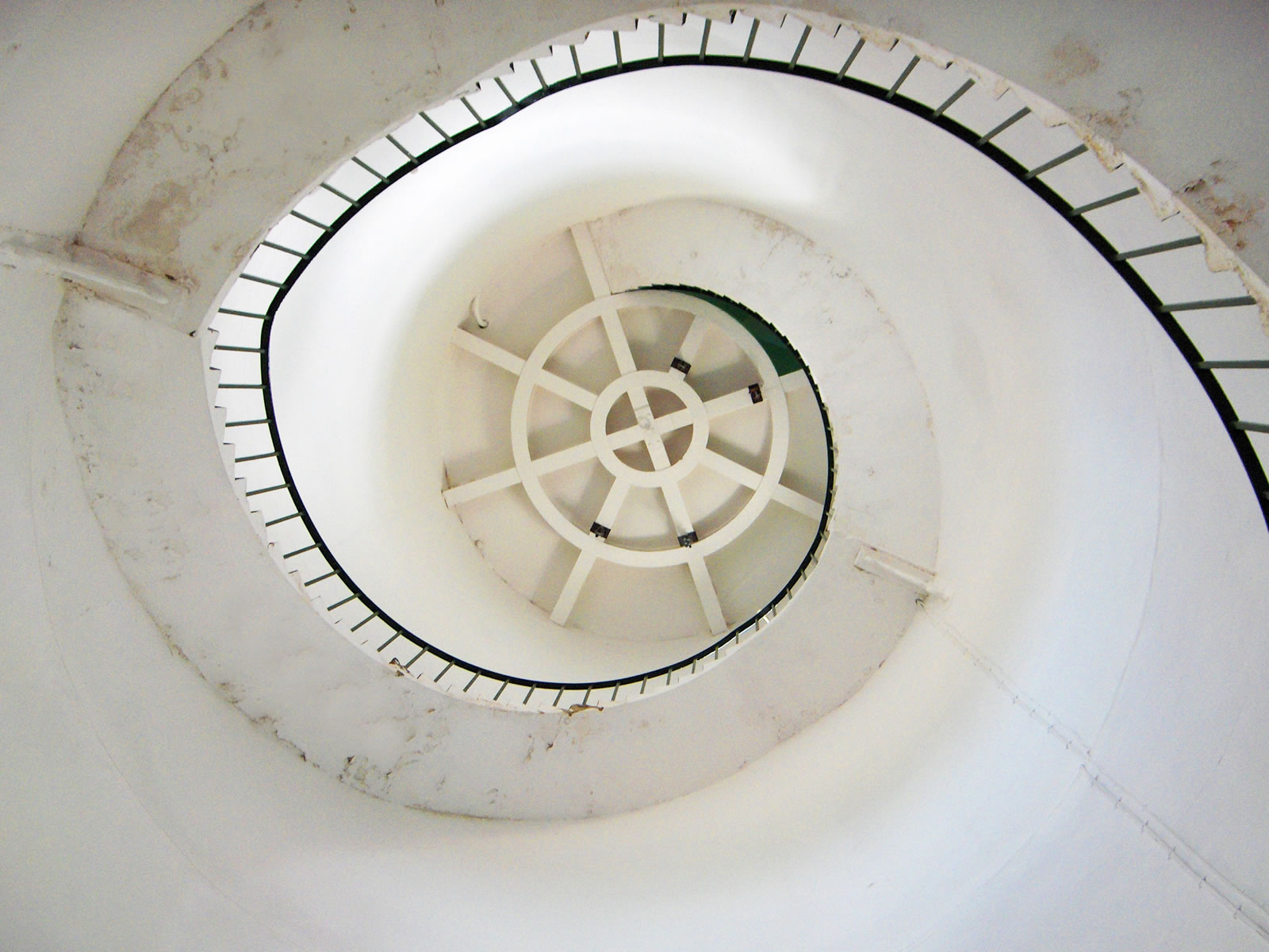 Today the lighthouse is painted white with three red bands, and has a light charcteristic of Fl (3) W 30s (3 white flashes, repeated every 30secs) with a range of 18 miles.
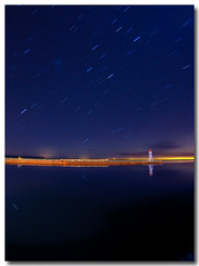
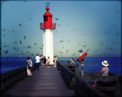
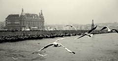
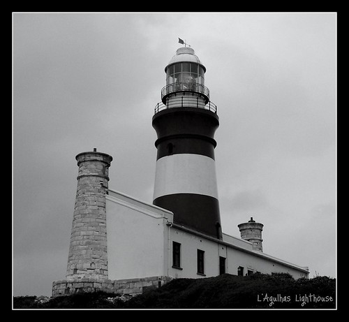 by
by 
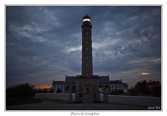


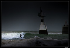
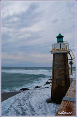
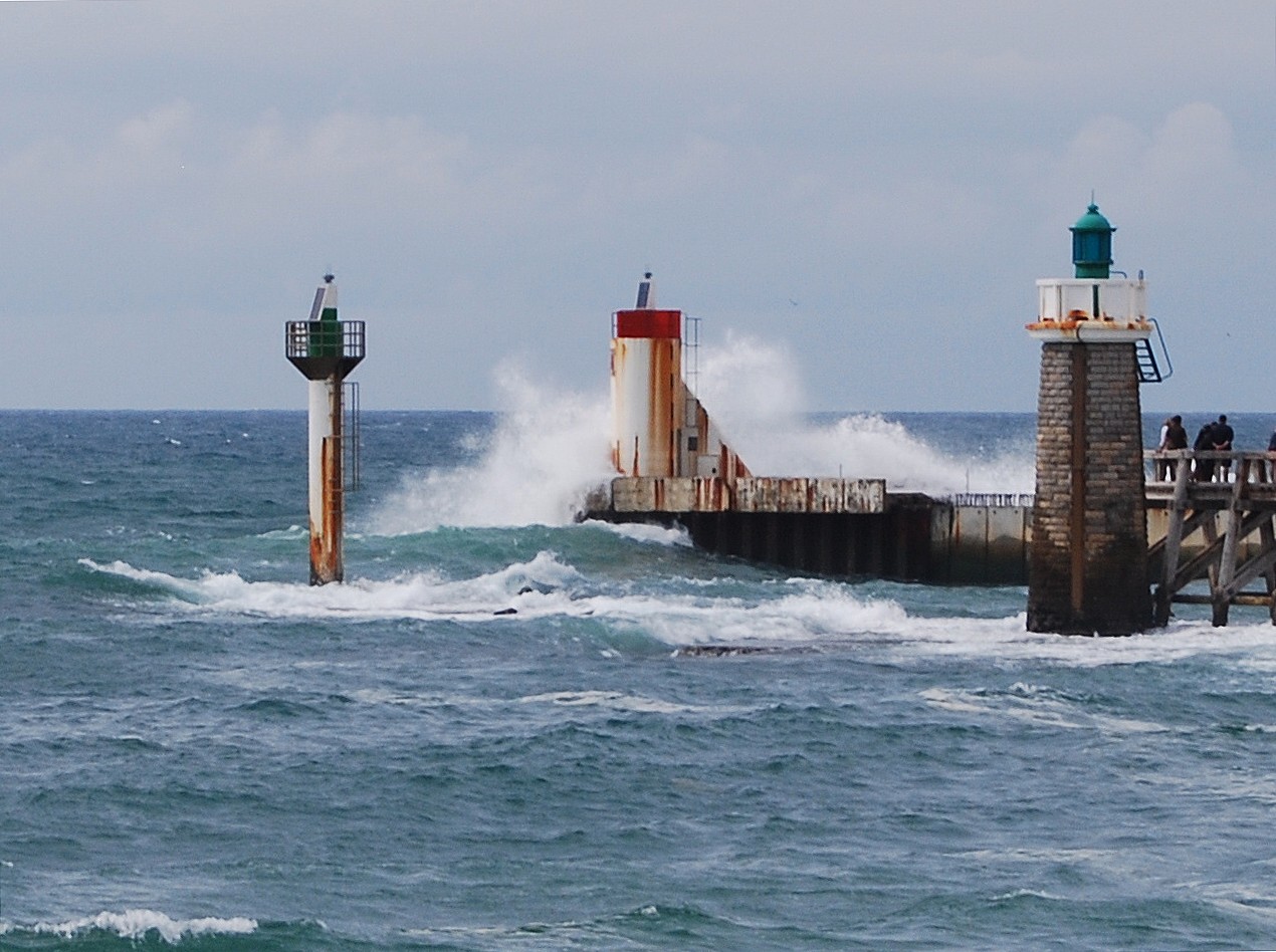
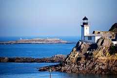
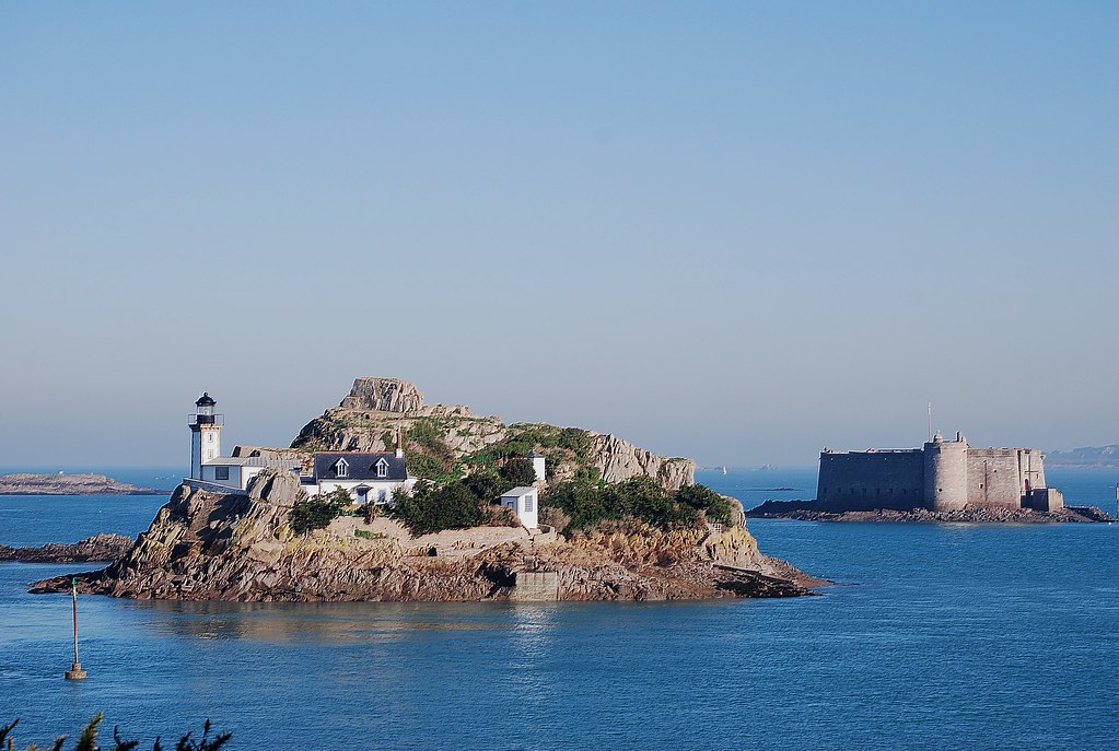


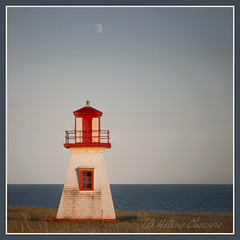


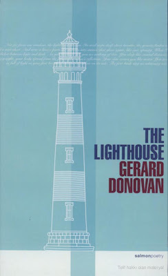
 Gerard Donovan, who was born in Wexford and grew up in Galway, is a graduate of Johns Hopkins University. The author of two previous collections,
  "Gerard Donovan is a man of two countries, teasing the beauty out of what lies in between. The LightHouse is easily his finest work so far, haunted, plaintive, hopeful and raucous. Like all good poems, they create a temporary silence around themselves, luring us in and stunning us. The LightHouse is a great collection." -- Colum McCann, Author of This Side of Brightness


.jpg)