
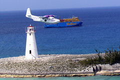


10 yıl önce
Burada Deniz Fenerleri listelenmektedir. Lütfen bilgilerinizi buraya aktarın.

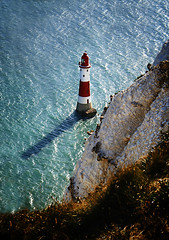
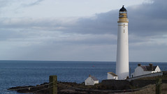
| Established | 1862 |
| Height Of Tower | 33 Metres |
| Height Of Light Above Mean High Water | 33 Metres |
| Automated | 1996 |
| Lamp | 35 Watt Metal Arc Lamp |
| Optic | 4th Order Rotating Optic |
| Character | White Group Flashing Twice Every 13 Seconds |
| Intensity | 89,900 Candela |
| Range Of Light | 20 nautical miles |
| Fog Signal Character | Sounding Twice Every 60 Seconds |
| Fog Signal Range | 2 nautical miles |


Author: Elinor De Wire
Lighthouses are symbolic of many things we cherish: guidance, safety, strength, a light to shine the way in a sea of troubles. These proud old sentries no longer have keepers and many have been upstaged by modern, high-tech navigational methods, but the towers and their dedicated caretakers remain alive in the pages of history. Some sixty five lighthouses still stand in the South, from the Outer Banks of North Carolina to Pensacola, Florida. With informative text and exceptional color photographs, lighthouses authority Elinor De Wire and photographer Daniel E. Dempster take you on a journey through the history of Southern beacons. "Lighthouses of the South" takes a captivating look at not only the lighthouses themselves--structure, interiors, and lenses--but also provides information about the construction of lighthouses, the history of the lighthouse service, stories of keepers and great rescues and wrecks, current preservation efforts, and much more. De Wires lively stories are accented by Dempsters outstanding photographs of lighthouses, interiors, and lenses. The book also includes a bibliography and an appendix that lists all lighthouses of the Southeastern Coast.
Format: Hardbound
Pages: 160
Length: 8.5w x 11h
ISBN-13: 9780896586031
ISBN: 0896586030
Catalog ID: 141372AP

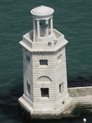
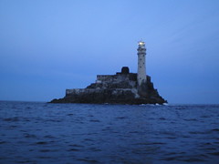
 Edgartown Harbor Light is a lighthouse located in Edgartown, Massachusetts that marks the entrance into Edgartown Harbor and Katama Bay. The lighthouse was originally built in 1828, but it was destroyed in a hurricane in 1938. It was replaced in 1939 with a tower relocated from Ipswich, Massachusetts.


.jpg)